Matobo is derived from a term that means “bare stones” in the local Kalanga language. The name was popularised by King Mzilikazi, who led a migrating Ndebele group that settled in the area around 1832 (Burrett et al., 2016). The colonial settlers bastardized it into a number of variations such as Matopo, Matopo Hills or Matopos.
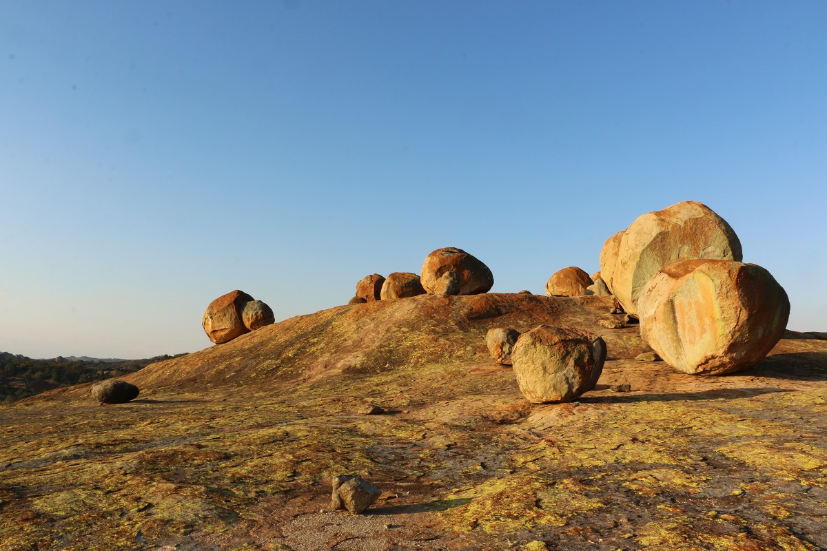
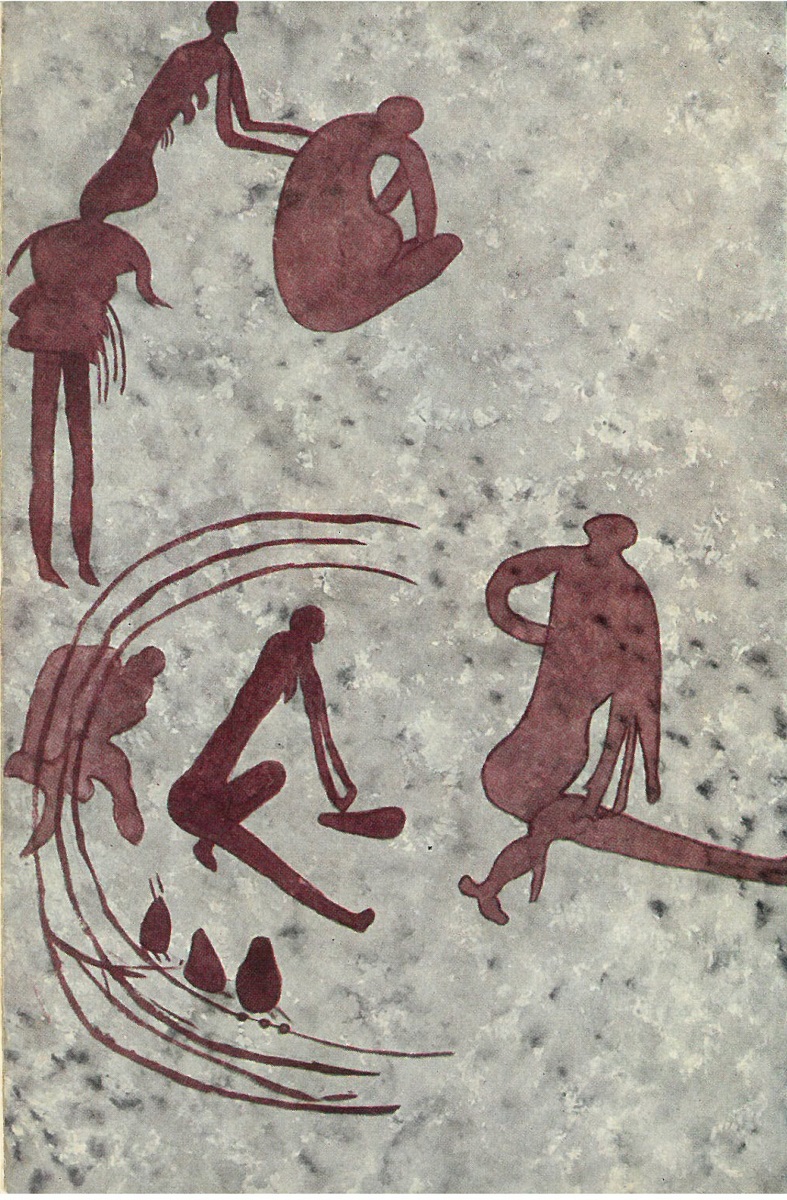
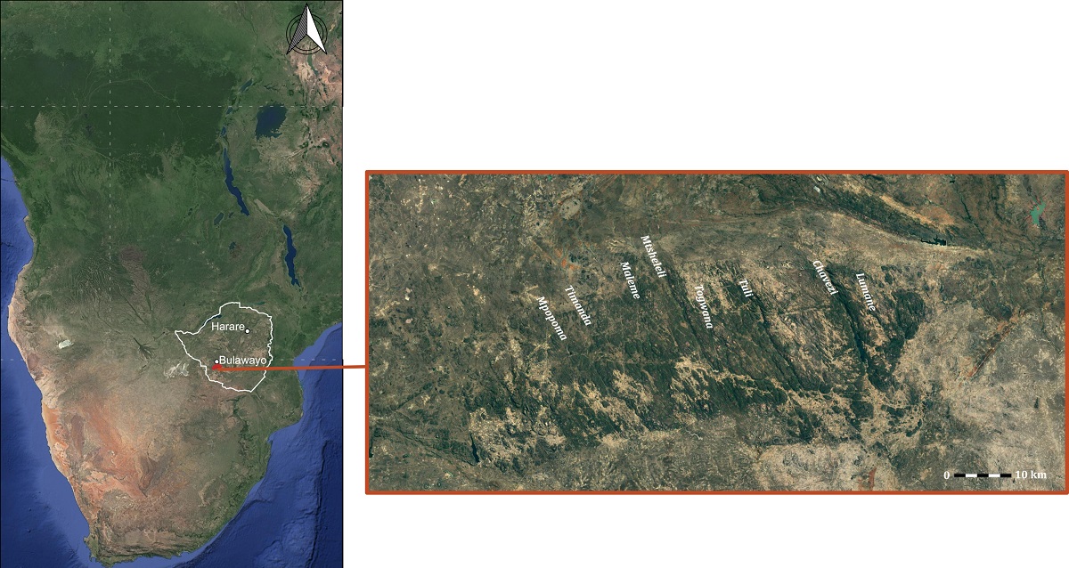
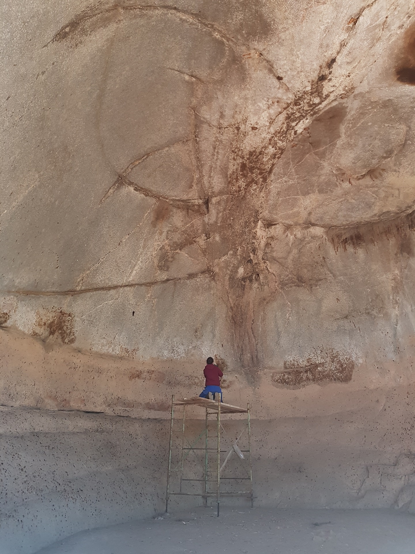
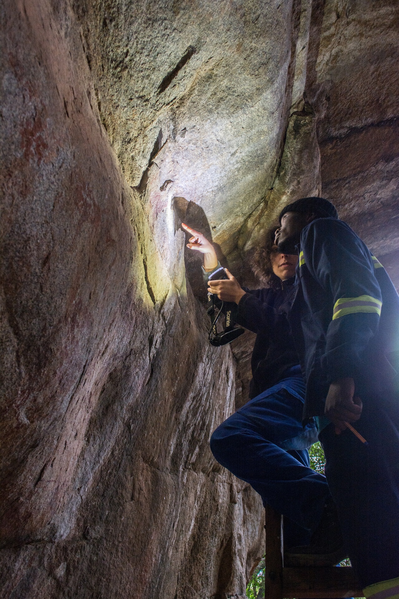
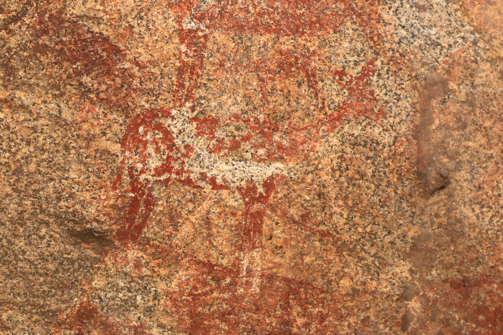
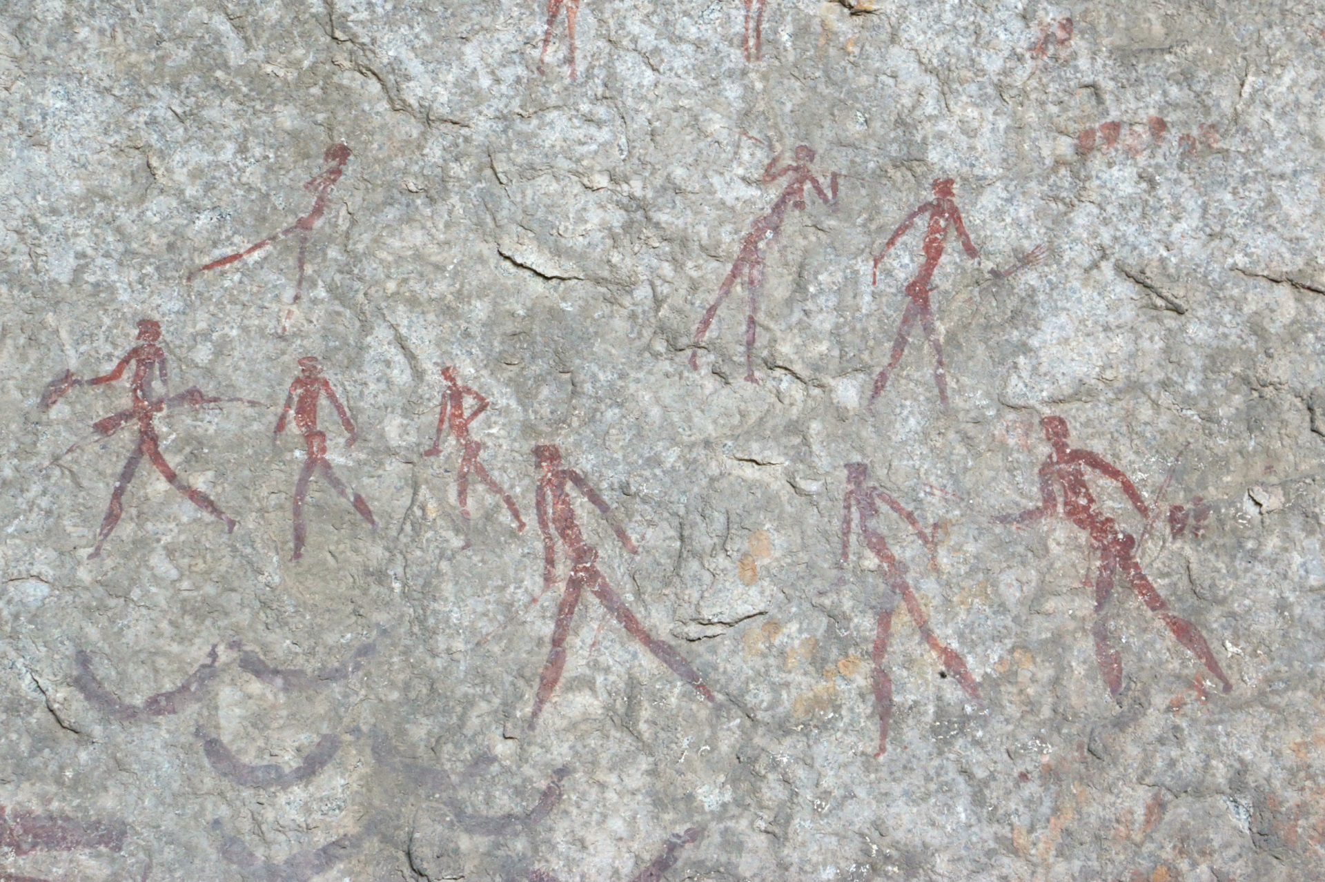
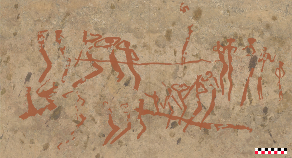
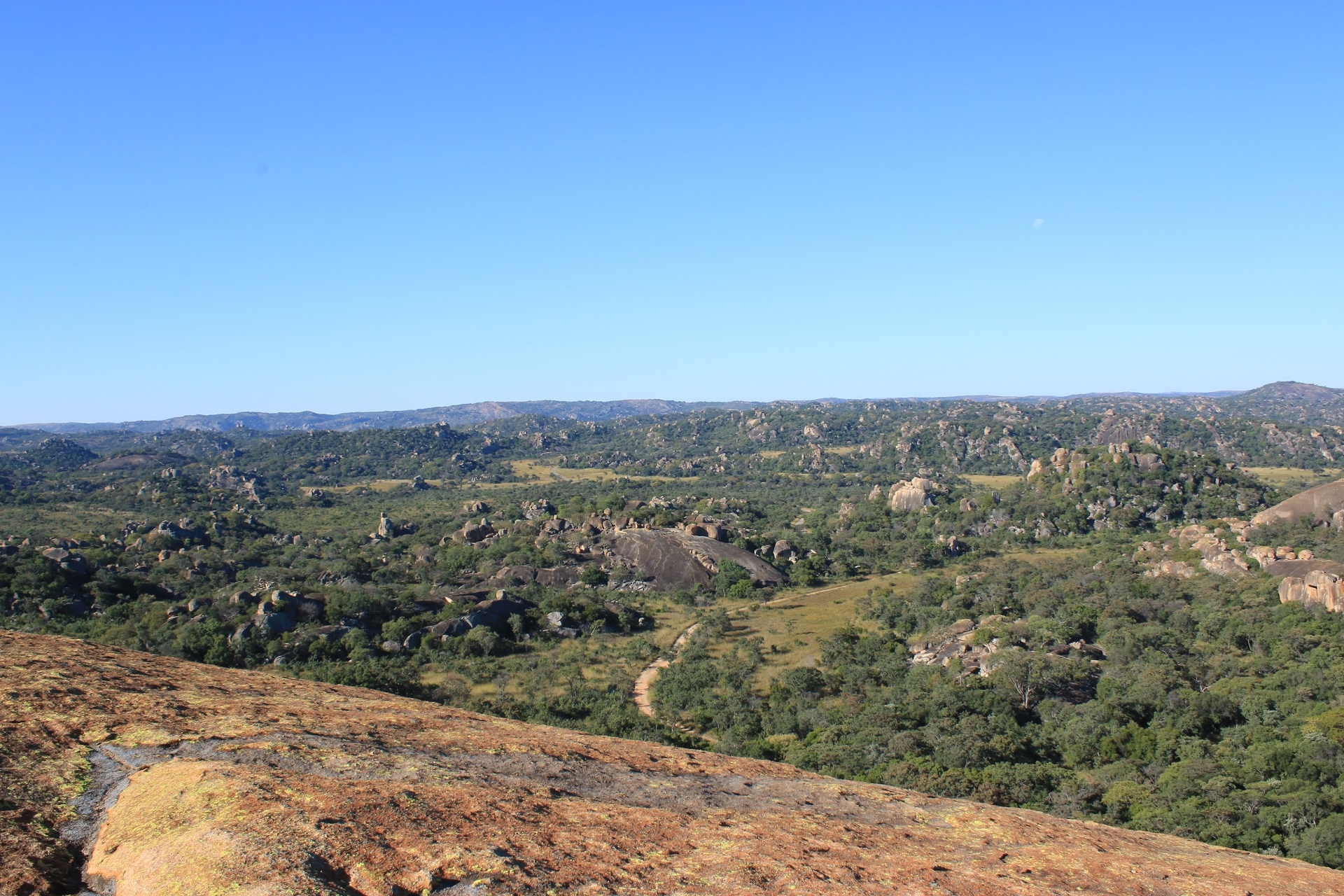
Located in south-western Zimbabwe, the Matobo UNESCO World Heritage Landscape forms the southwest margin to the Zimbabwean granitic shield. It lies at an altitude between c. 1200 and 1500 meters above sea level, at the border of the lowveld biome that makes the Limpopo-Shashe-Confluence-Area, the area of the three frontiers between South Africa, Botswana and Zimbabwe. Topographically, the Matobo comprises a series of hills that are generally separated by near-parallel N.N.W.-S.S.E. valleys where the rivers have exploited natural joints (Walker, 2012). The hills are mostly granite with a few intrusions of quartz, augen gneisses, older Archaean granites, grandiosities and dolerite veins (Smith, 1968). The Matobo batholith, brownish grey in colour, consists of medium-sized grains and is dated to around 2.6 billion years. It extends to cover about 2.050 km2 of World Heritage landscape and some surrounding areas (Kumirai et al., 2013). The granite weathers into various shapes and sizes which created a wide variety of rock formations: Large “whaleback” boulders, balancing rocks (“kopje”), cliffs (Smith, 1968). Concave spalling and related weathering processes often result in large rock shelters and rock overhangs which have provided a home to humanity as well as surfaces for paintings for thousands of years.
The Matobo lies in the Zambezian savannah biome, in a general semi-arid environment. Thanks to the altitude, the average annual temperatures seldom exceed 35 degrees Celsius. The climate follows a summer rainfall system, with increased precipitation during the summer months between November and February. Some perennial streams – Maleme, Mpopoma, Thuli – either run through or emerge from it before they eventually join the Shashe River and Limpopo River some 150 km further south. However, there are several more seasonal streams that bisect the landscape. Soils are mostly coarse and sandy, with few clay and organic soil pockets. Nevertheless, the variety of land features and their different response to climatic conditions offer a mosaic of habitats over short distances. The vegetation is characterized by forest vegetation mixed with shrub and grassland, typical of Highveld biomes. Hence the Matobo natural heritage includes a high botanic diversity of over 200 species of tree and over 100 grass species (Burret et al., 2016).
With this high diversity of vegetation and landforms comes a wide variety of fauna: 88 mammals, mainly small to large herbivores with 25 species of rodents, 13 of antelopes, 2 of rhino (including the almost extinct white rhino), and domesticated grazing species such as cows and goats, together with about 175 bird species and 16 fish species (Burrett et al., 2016). An exceptional density of predators goes with them (leopard, baboon, 39 snake species like python and black mamba, raptors).
(Ancila Nhamo, Camille Bourdier, décembre 2022)